Our Services
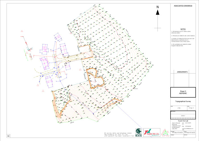
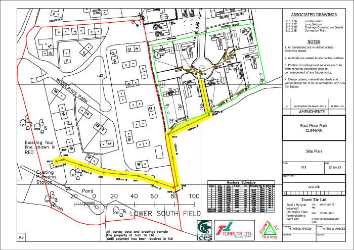
Topographical Surveys
Is the science of measuring features on the earth’s surface, recording of coordinated data for position and height. This data can then be used to produce a 3D contoured plan or map of the surveyed area.
Architects, Designers, and Engineers use this form of data to produce detailed drawings and designs to locate buildings, roads and structures on the surveyed area.
Contact UsSetting Out
“Setting Out” is the physical marking on the ground by coordinates, of the information taken from the detailed drawings that have been produced by the Architects, Designers or Engineers.
These marks on the ground can be with the use of flags, wooden pegs, steel pins or coloured spray paint. Giving the actual location where the building, road or structure is to be finally built.
Contact Us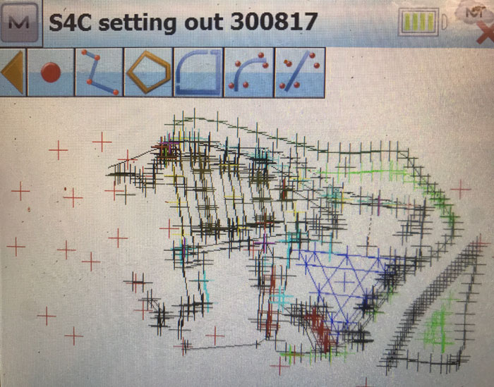
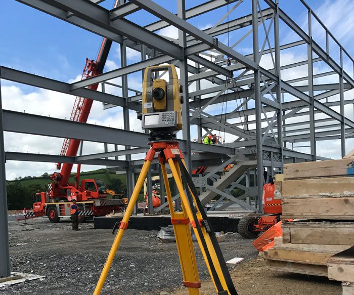
GPS and Theodolite Surveys
We use the very latest technology, GPS real time surveys, Robotic Total Station surveying or a combination of the two.
GPS surveying is utilising the NATO and GLONASS satellites which orbit the earth, to give a coordinated position on the earth’s surface to Ordnance Survey datum, which can then be recorded.
Theodolite surveying can be used where there is difficulty in obtaining a GPS signal.
Contact UsLaser Hire
We can offer a comprehensive range of construction lasers for hire, all at very competitive prices.
Rotating Lasers – for giving a level datum up to 30m, for foundations and building floor slabs.
Dual Grade Lasers – for giving a grade in two directions, for areas such as football pitches.
Pipe Lasers – for laying pipes at gradients where profiles and travellers just aren’t accurate enough.
Contact Us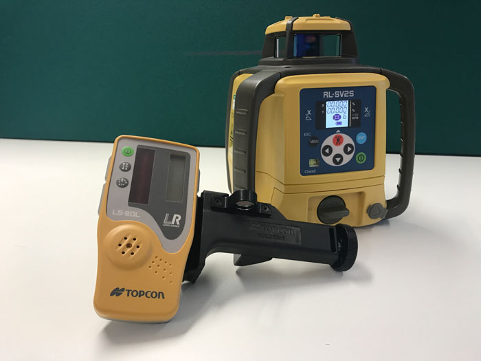
Section 104 and 106
We can offer a service to complete these sections from design to setting out for DCWW approval.
Contact UsRemote Data Collection
This is the surveying of points that cannot be reached physically or safely, these points are gathered with the use of lasers and other electronic means, an example of this method would be recording heights of power lines.
Contact Us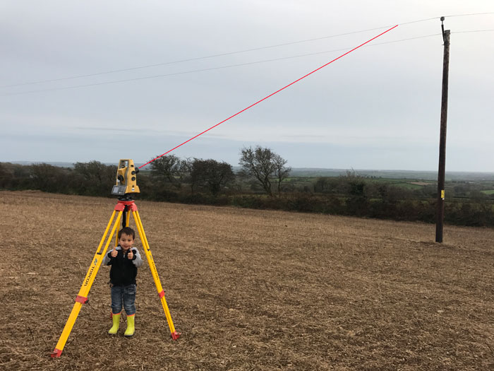
CAD
Computer Aided Design (CAD), all our surveys can be exported to the client in CAD or PDF format, which can then be emailed.
Foul and Storm Water Systems
We can offer a sewer survey service comprising of pipe routes, sizes, gradients, depths and CCTV surveys of the pipework.
Monitoring Surveys
Periodic readings taken of buildings or structures to record any possibility of movement.
TAN 15 Surveys
The surveying of flood plains or areas with possible risk of flooding, all data recorded to Ordnance Survey datum.
Measured Building Surveys
Surveying of the internal floor layout and external elevations of an existing building.
As Built Surveys
Surveys of the construction project once it has been completed, relevant information would be collated at the end or on going with the progression of work.
Contact us
If you would like to get in touch with use please call us or click on the contact us button below to fill in our enquiry form.
CONTACT US